


Menu
- Home
- Alaska Bear Viewing
- Alaska Flightseeing
- Alaska Trips & Tours
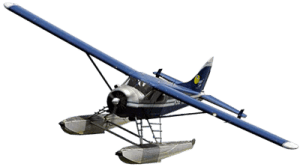
- Flight Charters
- Reservations
- About Us
- Contact Us
close
The Talachulitna River Float is a favorite among locals and visitors to our state. This river winds from the scenic Tordillo Mountains to the Skwentna River, right onto the wintertime Iditarod Trail. This river provides fantastic fishing, camping, and floating.
The Float Begins at Judd Lake were the Talachulitna Creek flows out. This section of river is quite shallow, meandering, and narrow Class I waters. This section most often requires lining or dragging the boats, especially at low water. From the confluence with the Talachulitna River the river widens and deepens considerably with many camping and fishing options.
Please contact us today to Book your Talachulitna Float Trip
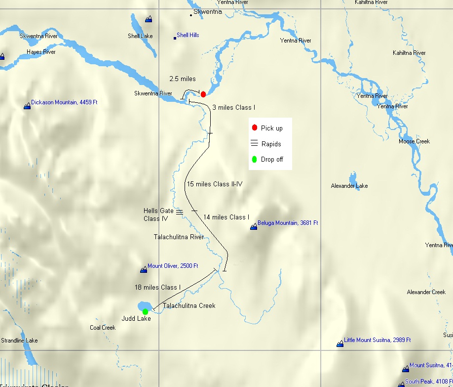
Drop Point: Judd Lake
N 61o 33.83’ W 151o 33.51’
Pick Up Point: Skwentna Canyon
N 61o 52.39’ W 151o 22.30’
River Length: 52 miles
Class of Rapids: I-IV
Average Float Time: 5 – 7 days
Round Trip Cost:
Cessna Cost: $1660
Beaver Cost: $2280
| Fish Species | Season Start | Season End |
| Chinook (King) Salmon | June 15th | July 13th |
| Sockeye (Red) Salmon | July 15th | August 31st |
| Coho (Silver) Salmon | July 15th | September 10th |
| Pink (Humpy) Salmon | july 15th | August 31st |
| Rainbow Trout | May 1st | October 15th |
| Grayling | May 1st | October 15th |
For the most up to date regulations please visit the Alaska Dept. of Fish & Game
www.sf.adfg.state.ak.us/statewide/reghome.cfm
USGS Quads: Tyonek C-4, C-5, D-4
Please visit our Alaska Links Page for a link to the USGS Store to purchase these maps.